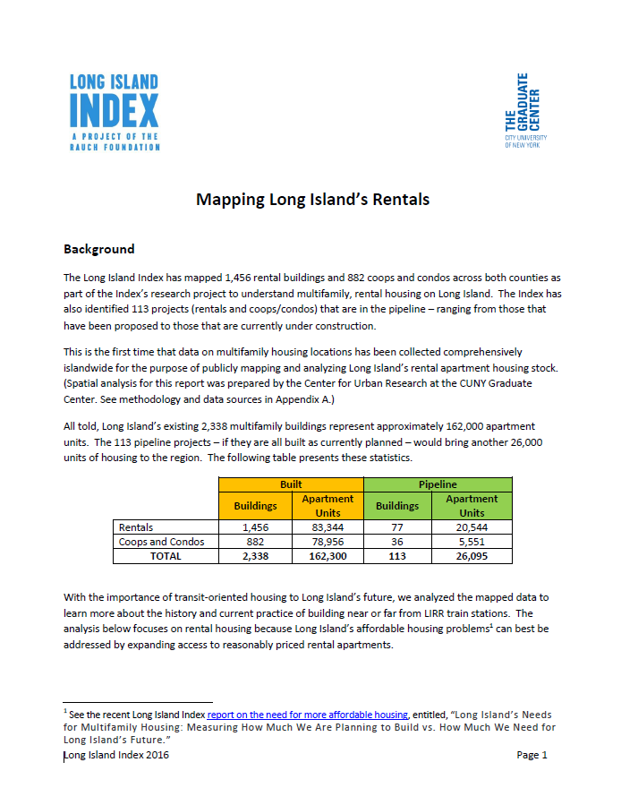
A report by the Long Island Index and City University of New York Mapping Service entitled, Mapping Long Island’s Rentals, documents the history of building rental housing near train stations. Historically, a substantial amount of rental housing on Long Island was built near train stations (as much as 50% before the 1960s), but the number of rental units built near LIRR stations from the 1970s to 2000 fell steadily; now only 30% of Long Island’s existing rental units in apartment buildings are within a half-mile of a train station. In recent years (since 2000) the number of rental units near train stations has increased, but that appears to be only a temporary reversal: the percentage of planned rental units near train stations has once again fallen. Only 27% of the proposed rental apartments in Long Island’s pipeline are within a half-mile of a train station.
The map provides the first and only online bird’s-eye-view of multifamily housing across both counties, as well as a wealth of detail within each community and for each individual housing site. The map displays rental and coop/condo locations in an easy-to-use format, enabling Long Islanders to explore any community on the island. Multifamily housing is defined as any building with three or more attached residential units and includes both rentals and owner-occupied buildings such as co-ops and condominiums.
Back to search results